


Location and Topography
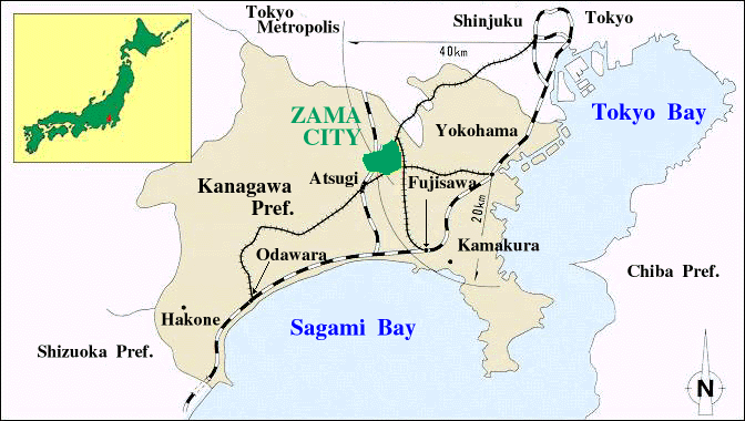
The city is located nearly in the center of Kanagawa Prefecture, about 40 km to the southwest of Tokyo and about 20 km to the west of Yokohama.
The zama Hill lies at the center of the city, and it devides the city from north to south. The Sagamino Plateau lies in the eastern part, and in the western part, an alluvial lowland extends along Sagami River.
- Data:
- East end : The east longitude 139°26′30″
- West end : The east longitude 139°22′20″
- North end : The north latitude 35°30′40″
- South end : The north latitude 35°28′00″
- Height above sea level :
- The heighest 88.74 m
- The lowest 24.29 m
- Area : 17.57Km2
- Length :
- East-West 5.3 km
- North-South 4.0 km
このページに関するお問い合わせ
秘書広報課 広報係
〒252-8566 座間市緑ケ丘一丁目1番1号
電話番号:046-252-8321 ファクス番号:046-255-5090
お問い合わせは専用フォームをご利用ください。